Let’s talk about history for a bit.
Just last June, archeologists from Cambridge and Ghent produced a revolutionary bit of research for the journal, Antiquity. In it, they described some problems and placed them against the immense possibilities that might come from the use of ground-penetrating radar surveys (GRS) on archeological sites.
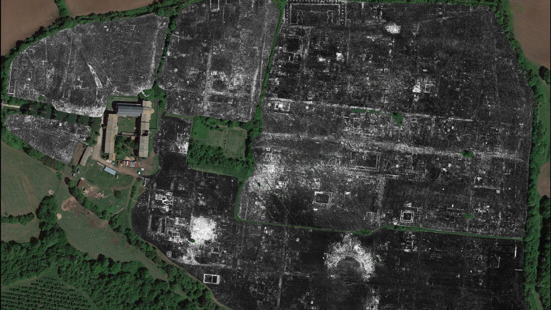
Here’s where it gets revolutionary. They were also able to map out a large chunk of the buried Roman city of Falerii Novi without any digging.
GRS vs. Excavations
Instead, they had a quad bike and wheeled around their GRS equipment to survey the city. Like a bat, GRS uses radio signals and sends them underground. The echoes that come back let archeologists determine depth and anomalies, which they then analyze and illustrate into a map.
If you’ve seen any media that follows an archeologist (sure, Raider counts), you’ll know that digging is an essential part of the work description. And, usually, the primary source of archeological information.
The problem with traditional modes of excavation is that they’re time-consuming and costly. That doesn’t even factor in that they’re intrusive. Meaning that if you’re not careful, you might destroy and weather artifacts as you find them.
On the other hand, while GRS isn’t cheap, it’s certainly non-intrusive and significantly more efficient. In 1829, previous excavations of Farelii Novi showed a theatre housing statues of Augustus, the first Roman emperor, and his family.
Monumental Discovery of Monument, Baths, Etc.
But with GRS?
Archeologists were able to find bath structures and other public buildings like temples and markets. Evidently, there are water pipes that run beneath the city blocks that provide strong evidence for previous, thoughtful urban planning. Plus, a possibly-religious covered pathway that led to a 200-foot long monument.
To put this technology into perspective, Pompeii, one of the most investigated sites, began excavation in 1748. The site and the city itself spread throughout 66 hectares. Today, they’ve excavated about 49 of those hectares.
In contrast, large-scale GRS work started in Farelii Novi, a city of 30.5 hectares, in 2015. It takes more than 20 hours to survey each hectare. Researchers involved in this project expect to finish surveying the entire area as early as 2021.
Of course, it doesn’t offer a complete picture of the city. Notably, shop units that appear in a different data collection set don’t show up in the GRS results. But considering the scale of data they were able to gather in such a short amount of time? It’s truly ground-breaking work, ironic pun very much intended.


